Sunday, June 25, 2023

Let the Wandering Resume

This is the first Wanderlusting Blog after my experiment with FB. This blog contains pictures and words I have already published on FB, but I have several friends who do not follow FB. Also, I like to do more with the blog than offer a travelogue of our journey. So, I will do a weekly version (as I have over the last three months.) I will rewrite some of the entries and add a bit of a preface and a postscript. Feel free to skip this and just read the FB posts. Or you can read this one exclusively. Or go ahead and read all of it. It is your call. I enjoy sharing our journey and look forward to having you along.

We began the week in Gig Harbor, WA, at the Sun Outdoor Gig Harbor RV Resort. Our week there was mostly about resting after 10 weeks of heavy-duty wandering. Toward the end of the week, we did get out and about as the weather cleared up and went to the local museum and maritime center.


The original people of Gig Harbor were the Puyallup Tribe. They settled in this area over 10,000 years ago and used it as their Fall and Winter fishing grounds. The salmon and other pelagic fish fill the river each Fall, and the catch would sustain the people through the winter until they returned to the inland to hunt and gather fruits, grains, and berries. This food gathering and storing required a high level of skill and generations of acquired knowledge. The women of the tribes were the carriers of this knowledge and skill. The first picture shows the modern generation's use of this technology. Imagine they are practicing a life skill that has passed through 500 generations! Each pattern is slightly different, and thousands of women have left their unique contributions to these vital pieces of daily life. 


The second picture is baskets from earlier generations. Unfortunately, these artifacts did not survive the 1000s of years. In them, we see these women's hard work and creative talents and the culture that grew out of their genius.


Gig Harbor, Washington, is a small town across the Narrows from Tacoma. When we got here, I knew nothing about it other than it was the location of our RV Park. There is a lot more to this place than a small harbor. In 1840 Captain Wilkes took shelter in this small bay off Puget Sound in his Gig, the captain's boat used to ferry passengers and supplies to and from the ship. This is a replica of that Gig, named the Porpoise. The mouth of the bay was too shallow for the ship, but it would allow the Gig to enter. The bay was called Gig Harbor, with tongue tucked firmly in his cheek.


Gig Harbor was settled by Europeans with a large community from Croatia who found a climate and coastline like their own. They were fishermen and boatbuilders who left their imprint on the harbor and community that grew around it. They built many boats in the "Mosquito Fleet" that provided ferry service and moving of goods around Puget Sound. They also made fishing vessels that fished the North Atlantic. It still has some fishing and builds a few well-known canoes and kayaks. But it is primarily a bedroom community for both Tacoma and Seattle and a weekend tourist destination. The Maritime and Community Museum was an excellent introduction to this small and historic village.


After our week in Gig Harbor, we headed north for the Olympic Peninsula. We traveled along Puget Sound and finally ended up on our old friend, US 101. We arrived in Port Angeles, WA, and set up for a week at Olympic Peninsula / Port Angeles KOA.


Port Angeles is located about two-thirds of the way from the Pacific Ocean at Cape Flattery and the mouth of Puget Sound on the south shore of the Salish Sea in the Strait of Juan de Fuca. It was named Port of Our Lady of the Angels by Spanish Explorer Francisco de Eliza in 1791. English settlers shortened the name to Port Angeles in the 19th century.


The city was twice anointed for greatness. The Federal Government, with the encouragement of Salmon Chase and Abraham Lincoln, laid out a federal city (second only to Washington DC) and sought to establish it as a Federal Hub in governing the Pacific Northwest. Unfortunately, their agent died in the Shipwreck of Brother Jonathan, and all government operations were transferred to Port Townsend. In 2003 a significant expansion of the port was planned with the cooperation of private and federal money. But when digging began, the workers uncovered the Clallam village of Tse-whit-zen, complete with the largest native burial site on record. The project was closed. 


The town, however, has thrived. Tourism became the primary industry, with the city serving as the major gateway to the Olympic Peninsula and Olympic National Park. In 2016, the town added Clallam Names for streets to the signs to recognize the long history and influence the Native People have had on the city and surrounding area. 


On our first day in town, we collected information for our week on the Olympic Peninsula. We went to the visitor Center at the National Park and the local visitor center at the harbor. 


One of the displays at the National Park was this whaling boat from the Indigenous People of the peninsula. It is roughly 25-30 feet long and 3-4 feet wide. Eight crewmen would set out on the Straits of Juan de Fuca in search of whales and seals. They carried harpoons, handmade rope, and a lance. They also brought centuries of remembered and shared skills, well-practiced teamwork, extraordinary seamanship, and a boatload of raw courage. Once a spout was sighted, they would draw near the whale using only the paddles you see in the boat. They would begin throwing harpoons, some with multiple sealskin floats attached to the line, into the flesh of the thrashing whale. The whale would drag them around the Straits for many hours, and when the creature was sufficiently worn down, they would draw up alongside and throw the lance deep into the whale's body. If all had gone as planned, they would have 50 feet and 35 tons of deadweight to tow back to the shore. These were sophisticated people who understood themselves and their environment. They took no more than they needed to feed the village and offered respect and honor to all land and sea and all that inhabited them. We will be visiting their reservation in the next few days.


I look forward to listening and learning from their thousands of years of accumulated wisdom about life on Earth. I hope you come along with me with the same deep respect and awe for these ancient people.


This is one of several picturesque spots on Cape Flattery, WA. This is the NW most point of the Lower 48 and represents the second most western point for the USA. James Cook first described it on March 2, 1778, when he wrote, "…there appeared to be a small opening which flattered us with the hopes of finding a harbor… On this account, I called the point of land to the north of it Cape Flattery." It sits at the mouth of the Salish Sea that does lead inland to the Straits of Juan de Fuca and Puget Sound and represents a significant portal to the US and Canada. The windswept rocks surround a heavily wooded headland. As we walked out to the point, we both had visions of the Dark Forest in The Wizard of Oz. The old-growth forest was littered with trees and brush sculpted into magical shapes by the wind, rain, and years. When we reached the viewpoints on the point, the Pacific Ocean opened before us. The coastline was rugged volcanic rock that had been weathered by the forces of nature and harbored an astounding amount of life. As we walked back up the trail toward the parking area, my soul was filled with wonder, awe, a keen sense of mystery, and a deeper appreciation for the hidden realm beneath the surface of life. 


This is a Harbor Seal, the smallest of the pinnipeds (marine mammals) that live along the Pacific Northwest. This seal and a hundred or more of their tribe were resting on the Race Rocks just off the coast of British Columbia. We were told that, unlike whales, pinnipeds could not live 100% of the time in the cold Pacific water. They must get out and warm up on rocks soaking up the sunshine. Therefore, they spend much of their lives lying around and soaking up the warmth. They live in groups and have learned that the best way to survive in Orca infested waters is to travel and hunt in groups, not unlike birds that travel in huge flocks to ensure that enough survive to carry the species into the next generation. The same applies to the harvest of seals by the Native People of the area, who relied on them for food and many other necessities for life in these harsh lands. A generation may lose a few to predation. Still, there will be enough survivors to create the next generation if the predators (humans included) kill only what they need and leave the rest to lay in the sun and produce babies. To paraphrase my favorite Vulcan, "May they live long and prosper!"


While we were on a Whale Watching Cruise out of Port Angeles, see Puget Sound Express Cruises) we met Blizzard, the Humpback Whale. Every Humpback has distinctive markings on its flukes (tail flipper.) Shots such as these are sent into a central registry that records and tracks them as they are sighted. This fluke belongs to a 20-year-old whale (unsure of the sex) who was first sighted in Hawaii in 2012. It was spotted in the breeding grounds off Maui, so researchers believe it was likely 10 years old. Blizzard was feeding in the Straits of Juan de Fuca, and it has done over the years. These whales do not seem to eat when they travel to Hawaii for breeding. They lose as much as 30% of their weight on the journey there and back, so they must return to their feeding grounds, where they calve and regain up to 15 to 20 tons of weight. They have an esophagus the size of a grapefruit and eat tiny shrimp and small fish. I struggle to imagine how much they must eat to regain that much weight. I also struggle to imagine that much food in the Straits to feed all these huge, hungry creatures. Blizzard and its kin are incredible creatures and stir my soul whenever we encounter them. By the way, that pink stuff in the water is Whale poop. Answers that age-old question, does a whale poop in the ocean?


At the end of the week, we will head out and journey around the Sound through Tacoma and head to the Seattle Metro area and stay in Lake Pleasant RV Park in Bothell, WA. We look forward to seeing our Son, his spouse, and the Grands. We hope to spend time with a good friend as well. It will be a very busy week, and I hope you come along with us.


Before closing this week’s blog, I want to say a word about my travel companion for the last 50 years. This picture was taken from the Glacier Spirit while we were out on the Straits of Juan de Fuca looking for whales. Marlene has been at my side for five decades. We started dating in 1973 while students at SWT in my hometown of San Marcos. Since that time, she was walked with me through forty-plus states, three provinces, a Caribbean island, and half a dozen or so houses and apartments. She has endured my companionship with the same smile that first led me to notice her across the Music Building in the Fall of 1972. We became friends and then best friends. And now, 50 years later, I still cherish each day she allows me to hang around with her. I am deeply thankful for the years that have passed under our bridge. But that gratitude is nothing compared to the anticipation that fills my soul for the rest of the journey, still coming down the stream. I love you and cannot imagine making this or any other journey without you!


Bob


Sunday, June 18, 2023

Time for a Break

Our week started at Cascade Locks / East Portland KOA Holiday in Cascade Locks, OR. Located just across the Columbia River from Washington, the city bills itself as the Heart of the Cascades. This makes sense since it is in the middle of the Columbia River Gorge, and the gorge runs through the middle of the Cascade Range. We enjoyed our time in Cascade Locks, so named because it was the site of the first locks built on the Columbia River to avoid a portage around the rapids. It is an old city whose fortunes have varied with the fur trade, the lumber trade, fishing, and tourism. 

Speaking of the rapids, these were the result of the gods building a bridge across the Columbia River roughly 700 years ago. The north side of the river is made up of packed ash and other erodible materials. Occasionally, the cliffs give way and tear off a piece of the mountain. Native storytellers speak of when a sizable part of the mountain slid down and completely blocked the river. They called this new way across the river “The Bridge of the Gods.” Eventually, the river found a path through the slide, forming the rapids. The native people learned to navigate through or portage around the rapids. The fish made their way through to spawn in the creeks above the rapids. Fur Trappers for Hudson Bay Company followed the lead of the native people. But as the greed for furs grew in Europe, a lock was built to allow river boats to bypass the rapids and save time and money. Thus, the locks were built, and the small community was named. 


In time, the value of the resources increased, and the river needed to accommodate larger vessels. The City of Portland was also growing and needed more electric power, which required the building of hydroelectric dams. The first dam for the Columbia River system was built just a few miles downriver from Cascade Locks. Bonneville Dam powered Portland and drowned the rapids at Cascade Lock. A lock was constructed at the dam that would allow ships upriver. The dam was extended as development increased, and a second, even larger lock was made. Unfortunately, the dam cut off the river for the Salmon and other fish that used the river as a path to their spawning grounds. It also drowned the traditional fishing area of the Chinook Indians. It led to their displacement from the land they had inhabited for thousands of years. The Federal Government built a large fish ladder to enable the fish to find their way around the dam. The ladder is also an opportunity to count the number and species of fish that are using the ladder. Unfortunately, one species does not utilize the ladder, the Columbia River Sturgeon. These are struggling with the loss of habitat. The over-fishing of the river has led to a smaller and smaller catch. Still, conservation efforts continue, and the fish are now being shared with the natives who have relied on them for centuries. The USA is giving back the fish we have taken from them over the last hundred years. Small efforts are assuaging a colossal injustice.


Bucket Lists help us keep track of unique places and experiences we want to see and do. Some folks have formal bucket lists and plans for visiting them. Others of us have general ideas of places and events that we hope to see in the future. But generally, these lists carry expectations, and this is the problem for me. This is Multnomah Falls along the Columbia River Gorge. It has been on my bucket list for years. 


I remember the feeling I had when I saw my first bucket list place, the Grand Canyon. I was overwhelmed by the experience. I had expected a big hole in the ground, but the majesty and breadth of the canyon were so much more. I was in awe. I had a different experience in Multnomah Falls. They were just as I had pictured them from a lifetime of seeing pictures. But the bridge was not as high as I expected. The sound was not as loud as I had anticipated. It did not fill me with the awe and wonder I had hoped for in the experience. They were more impressive than the other falls but were no “Grand Canyon.” I need to sort my own bucket list a bit differently. The Grand Canyon was a “WOW!!!”  Multnomah was a “Yep, that’s it!” I am glad we saw the falls, but I will not need to return. The Grand Canyon? That is a different story!


The Columbia River Gorge is lined with countless streams of life that flow over the rim. This is Bridal Veil Falls Creek, just below the falls that tumble from the shoulder of Larch Mountain. It. Like the other creeks, it is fed by snowmelt and springs that trickle through the porous volcanic ash and then pool along faults in the solid basalt that make up the core of the Cascades. Life flourishes because of these life-giving streams. The flowing water creates the soils that surround them. They make sand that offers nesting materials for all kinds of aquatic life. They form highways for creatures to leave their nests to explore the oceans and a route home to complete their lives in the spawning grounds upstream. They feed the struggling souls of travelers who sit and listen to their music and become entranced by the dancing waters. They offer life-giving water to the thirsty, shelter to the homeless, and refreshment to the weary and worn. May we all take the time to be restored by the streams of life that flow through the chasms of our daily journeys.


After a week of exploring and enjoying the Columbia River Gorge, it was time to move on. We drove three hours to Sun Outdoors Gig Harbor in Gig Harbor, WA. We planned to stop for lunch at a rest area along the way, but unfortunately, it was closed. We wandered on. We found a truck wash up the road and pulled in to give Koko and Nakai much-needed baths.  While the workers cleaned, we munched on chicken strips we picked up at the last gas stop. We arrived at the campground and were delighted to find another tree-shaded site that would be the perfect respite from long weeks of travel and sightseeing. Gig Harbor has just enough to offer to keep us happy, but not so much that it would overwhelm our desire to explore. We were looking forward to a relaxing and refreshing week.


We walked down to the harbor front for the weekly Farmer's Market. While there, I learned a bit about Gig Harbor. It is named after a fishing boat Captain who landed his gig, a small boat, in a sheltered harbor of the sound. From that day on, it was referred to as the harbor where the Captain landed his gig. The first venture into the port was followed by immigrants from Scandinavia and Northern Europe who brought their skills at fishing with them. They were not unlike our modern-day immigrants from Mexico and Central / South America. They came with a desire to provide a good life for their families. They were not afraid of hard work and expected nothing but an opportunity. These working-class immigrants spoke a different language and formed tight-knit communities away from the Anglo majority. They maintained as much of their culture as possible to preserve the ties to family and friends left behind. They took pride in their culture and wanted their children and grandchildren to share that pride. They were objects of suspicion, fear, and discrimination from Anglos, who had forgotten their immigrant roots. But these hardy souls persevered and, with hard work and deep reservoirs of faith, founded a community and made a life for themselves and generations to come. I celebrate these brave women and men and offer this ode to all working-class immigrants like the statue pictured above. Welcome; we are a better society because of you.


This is the path to Bridal Falls, and it symbolizes what our wandering lives are all about. It is a switchback on the trail that allows us to drop down to the base of the falls without having to fight a steep grade. It is not the shortest way and, in fact, can feel like we are wandering around in the forest. But it offers the safest way to get to places that ordinarily require ropes and hiking apparel. Instead, the journey becomes a long but pleasant walk in the woods. Wandering is not a very efficient way of traveling. Some would say we are wasting time with our way of traveling and could see a whole lot more if we streamlined our travel habits. These folks are correct. We spent many years traveling more efficiently. But travel is tiring. And hurrying up and down paths like the one above takes a lot out of us. Now that we have the time, we are not wasting time. We are investing it in seeing and experiencing life. I hope all my friends will have the opportunity to invest their time well and discover that life has so much to offer if we find the wandering paths down the steep slopes of life. With luck, you can dip your toes in life's cool, refreshing waters.


As I bring this week to a close, we are nearly halfway through our 2023 trip. We have been on the road for 3 ½ months and hope to return to Central Texas in 4 months. It is time for a break from touristing! Our last change in plans has brought us to a lovely community with few touristy enticements. Therefore, we will be wandering through our week. Our plans? I downloaded the first book of a new Sci-Fi series. I have this weekly blog and my journal. Koko and Nakai always need some TLC. Facebook and Zoom connect us with friends far and near. There are naps to be taken and sunshine to be soaked up. We have a few days to enjoy the gift of our wandering life, free from the distractions of things to do and places to go.


Later in the week, we will head out to the Olympic Peninsula / Port Angeles KOA Journey in Port Angeles, WA. Touristing will resume as we cruise to see some Orca and hopefully some of the elusive Puffins. We will have sandy spits to walk and mountains to drive. There is a rainforest to explore and many other yet unknown adventures awaiting us. We rest while we can and look forward to resuming our wandering ways.


Glad you are along for the ride.


Bob

Monday, June 12, 2023

A Sustainable Abundance

We began our week in Kamper West RV Park in Warrenton, OR. This park was located a quarter mile from the Columbia River. It was an excellent place to explore the northern Oregon and southern Washington Coast. As we ended up our time there, we explored a Maritime Museum and took a trip to Cannon Beach. I have encountered the abundance of creation and how sustainable our lives could be all week. 

One of the recurring questions of the last few weeks is why were so many European explorers searching this part of the globe? This is a map from the Age of Exploration in the 18th century. It suggests that there is a passage to the Northwest of the Pacific that would make dangerous trips around the tip of Africa or South America unnecessary. Sir Francis Drake, George Vancouver, and James Cook were sent by Britain. France, Spain, and Portugal did the same, believing whoever found the passage would control the merchandise flow from Asia and Western North America. Many sailed right on by the Mouth of the Columbia River, thinking it was just a Bay. But a few courageous and, perhaps, foolhardy captains crossed the bar and did find a river that opened vast stretches of land in North America to European merchants. But even the Columbia did not extend into a Northwest Passage. Ironically, with global warming and the melting of the Artic Ice Cap, the Northwest Passage now exists over the top of North America. But the great age of exploration was driven by far more than curiosity. The prime reason was a thirst for wealth and power.


After a good night's rest, we went to Cannon Beach, South of Warrenton, searching for Tufted Puffins. These quirky little birds have fascinated us for years, and when we read that they roosted on the sea stacks of Cannon Beach, we knew it would be a high-priority stop. Cannon Beach is named for cannons from the 19th-century USS Shark wreck that were found buried in the sand. The largest and most famous of the sea stacks is Haystack Rock. But there are other large sea stacks along the shore. We arrived and had to circle for 15-20 minutes to find a parking place. Once parked, I slung my camera with bird lens over my shoulder, and Marlene shouldered her scope with a tripod; we slogged through the crowded street and then the soft sand. The wind was blowing and felt colder than the 58 degrees we were promised. As we approached the rocks, we could see thousands of birds roosting, flying overhead, or floating in the surf. We set up on the beach and saw cormorants, murres, several species of Gulls, Bald Eagles, and a pair of Harlequin Ducks (a new species for us.) But alas, no puffins. No one else had seen them either. Our search continues for our first Tufted Puffin.


I mentioned that we saw Bald Eagles. In fact, we saw a pair who were hovering over the sea stacks. The lead bird swooped in to chase the adult birds away from the nests, and the second would follow in hopes of snatching a chick from a nest. They took several unsuccessful runs, but then we noticed that one of the birds was heading for the trees behind the beach. In its talons was a large Gull chick. The other Bald Eagle followed the first and was chased by a distraught Gull offering all kinds of Gull curses. This is the way of life. The loss of a Gull chick would provide for a single Eagle chick sitting in a nest, waiting for its parents to arrive with food. That is why there are so many Gull Chicks. Some will survive the predators and raise another generation. Creation is lavish in providing for life, but there are winners and losers. It is part of the design of nature. Nature can adjust to meet the needs of all the species. I am not sure that nature can adapt to meet our greed rather than our needs.


Thursday was a travel day, and we got up early to get Koko in for an oil change before setting out for Cascade Locks, OR. After an oil change and an early lunch, we set off for a beautiful drive along the Columbia River. A quick jaunt into Washington allowed us to bypass much of the Portland traffic, and we arrived well-rested and ready for new adventures. Our campsite at Cascade Locks / East Portland KOA was very nice, and we are still about a quarter mile from the Columbia River. We have a nice canopy of trees. The air is heavy with the scent of pine and spruce. Once again, nature provided a lavish setting for our week along the Columbia. We are glad to be in a new place for another week of wandering around. 


Unfortunately, our first full day in the new campsite fell into our unfortunate pattern. We had a day of cold rain. Making the most of the situation, we drove over the Bridge of the Gods and checked out the Columbia River Interpretive Center to get the "lay of the land" for our week. The museum told the story of the River and its inhabitants. The one exhibit that really touched me was this image of a native fisherman netting salmon from the rapids in the river. A dip net supplied a year’s worth of fish for his tribe. The river provided an abundance for those who lived along its banks.


This picture shows what the Europeans used to catch salmon from the same river. Looking closely, you will see our lone native fisherman next to this behemoth. The colossal wheel included two constantly moving dip nets that scooped up the fish and slid them down a chute. From there, they went to the knives of the cannery worker, who packed them for shipment within hours. These machines fed a corporate need for "product" to compete in a global market. These economic machinations have led to unsustainable levels of fishing. The Native people lived off the river for thousands of years. They have lived long enough on the land and waters of the Northwest to understand sustainability. Yet in a little more than a century, we have nearly destroyed the Salmon stock in the river. As the old saying goes, "Creation provides more than enough to feed our needs, but it cannot feed our greed.”  


We woke the following day to sunshine and the promise of 70-degree weather. We packed up Nakai and headed for Mount Hood, the dormant volcano just south of Cascade Locks. Our wandering took us along a portion of the “Fruit Loop,” an autoroute through orchards and farmland along the East and West Forks of the Hood River. There were acres of small and large farms, fruit stands, and farmer’s markets. Creation's abundance surrounded us. Many of these farmers have listened to the lessons of sustainability. They are working with nature to produce a bounty of fruits and vegetables for the US market. But these are not Southern California's mega-sized factory farms and orchards that rely on chemical fertilizers and precious water from the Colorado River system. Instead, the Fruit Loop has manageable orchards and truck farms that produce high-quality food and flowers. They rely on the fertility of the volcanic soils and the plentiful water from the snowpack and glaciers on Mount Hood. Yep, we bought some fresh cherries and strawberries. Abundance is a sweet taste to hungry wanderers.


I was in awe with my first glimpse of Mount Hood. This is an 11,000 ft. rock that rises out of nowhere. We came around a bend and crossed a bridge over a vast ash flow. The storyboards explained that global warming had reduced the glacial coverage of the ash fields on the volcano's flanks. When a storm of the century came through in 2006, it created a river of mud and ash that took out the highway. The state rebuilt this vital transportation link, but storms continued to wash out the roads and build up a river of ash. The world's insatiable appetite for electricity from fossil fuels is eating away at this ancient landscape. We are literally spoiling our nest. The majesty of the volcano presides over the slow and inevitable changes that will have unforeseen, negative consequences for our children and grandchildren.


We continued around the volcano and ended up on the Historic Columbia River Scenic Hwy. This is old US 30 that parallels IH 84 through the gorge. It was built in the early part of the 20th century to promote tourism to the many waterfalls that spill out of the cliffs of the gorge. It provides overlooks and pull-offs for seeing the sights. This image is from the Vista House, an ornate rest stop along the road that allows the driver to take a break from the twists and turns of the scenic drive. There is a wealth of beauty in this area. Still, we must accept our responsibility for the treasure for future generations. The road was built to help people appreciate this beauty. That is what sustainability is all about, and it is something we need to learn again and again.


Most of the pullouts were filled with cars and crowds. Being a Saturday, we decided to leave them for a return trip during the week. But the pullout at Shepherd Dells Falls was empty. Taking our opportunity, we parked and made our way to the stairs on the cliff. This is a beautiful little cascade down a dark gray basalt cliff. It was an excellent taste of what awaits us when we return in a few days. After a few pictures and lingering at the water’s edge, we slowly returned to Nakai. The day had lavished a lot of hope for our stay along the Columbia. 


Our few days in the Sun convinced us that we had had enough of the windy, cold weather of the Pacific coast. So we changed our next stop to one just north of Tacoma, in Gig Harbor at Sun Outdoors Gig Harbor. A few more days of warm temps and sunshine will prepare us for our coming weeks on the Salish Sea and Puget Sound. 


Come on along and enjoy the abundance!


Bob


Sunday, June 4, 2023

The Dramatis Personae of the Oregon Coast

We began our week at Premier RV Resort in Lincoln City, OR on the Central Oregon Coast. It generally takes me a few weeks to get a feel for an area, and the last month along the Pacific coast in Northern California and Oregon is starting to present an exciting cast of characters in its story. The Native People who have called this place home for 10,000 or more years had an early role, but they have been pushed aside by people from Russia, Europe, and the United States. The early explorers and fur trappers left their mark on the land and the people, but they were replaced by settlers who came by land and sea. They have been supplemented by fishermen, loggers, and merchants who eventually yielded to corporations and stockholders. But these are not really the principal actors in this saga. The main actors have been here far longer than the Native People and will still be here when we become a distant memory in the land. This is principally a drama of earth, wind, fire, and rain embodied in the sea, the rivers, the wind, the sand, the volcanic rock, and the fires far beneath the whole area. This week I discovered how vital these main actors are in sculpting this remarkable landscape.


We begin on Memorial Day and the ubiquitous crowds that head to the beach for the unofficial first weekend of Summer. We drove down to Depoe Bay, a small village along the coast, but found the town filled with people. We drove on to the Otter Crest Scenic Drive between Depoe Bay and Newport. This was classic Oregon Coast. We stopped at a seafood shop at the Devil's Punchbowl for lunch. The Punchbowl is a sea cave with a partially collapsed Roof. We were at the less-than-optimal low tide and could only see waves washing into the bottom. And yet the crowds were all around. 


I was more interested in how the ocean waves interacted with the volcanic sea stacks surrounding the Otter Rock Headland. This picture shows the aftermath of the waves creating a spectacular flowing fountain on the rock. After the wave recedes, the real work takes place. The plants that the water supports are anchored into the rock and provide shelter and food for creatures large and small. The wave action supports tidal creatures in the nooks and crannies of the rock. Birds, Sea Lions, and Harbor Seals use the rocks for nesting and resting. This rock made its way to the surface as magma and was lifted above the water. There the wind and water covered it with waves that gave it shape, life, and beauty. I, along with all the crowds, could only marvel at the handiwork of time as it craft such beauty from earth, wind, fire, and rain. 


The next day we explored the lighthouses of Yaquina Bay. There are two of them. The first was built at the mouth of the Yaquina River. It marked the opening of the bay so that ships could find their way in while avoiding the rocks that line the shores on either side. This lighthouse was only in service for three years. The lighthouse did not have a powerful enough light and could not be seen through the dense sea. Newport, the city at the bay, was a vital link in trade for the area, so a new lighthouse had to be built on the Yaquina Headland a few miles north. This one was closed. This lighthouse is unique in that the lightkeeper and family lived in the lighthouse itself. The lightkeeper’s commute was a step ladder. Talk about working from home!


This new lighthouse was built at Yaquina Headland. It is the tallest lighthouse on the Oregon Coast and has a powerful First Order Fresnel Len that could warn ships of the surrounding dangerous currents and shorelines. It allowed them to navigate into Newport. Each lighthouse had a unique light sequence that included multiple flashes of red or white light to help the navigator know where they were in the dark. They were also painted with a unique pattern to distinguish them from others along the coast during the day. This one still provides light to ships at sea but is now completely automated and no longer has a lightkeeper. It still shines up to 19 miles out into the Pacific. When sailors see it, they know that the dangerous Cape Foulweather lays to the north and Yaquina Bay sits to the South. Charts are nice to have. GPS is very valuable. Having navigated my share of back roads and jeep trails, finding my way with visual confirmation is always welcome. This lighthouse is the "big tree" that tells you that your turn to Aunt Tillie's house is very close. We have had to adapt to the work of the earth, fire, wind, and waves along this coastline. Lighthouses are one adaptation we have made. 


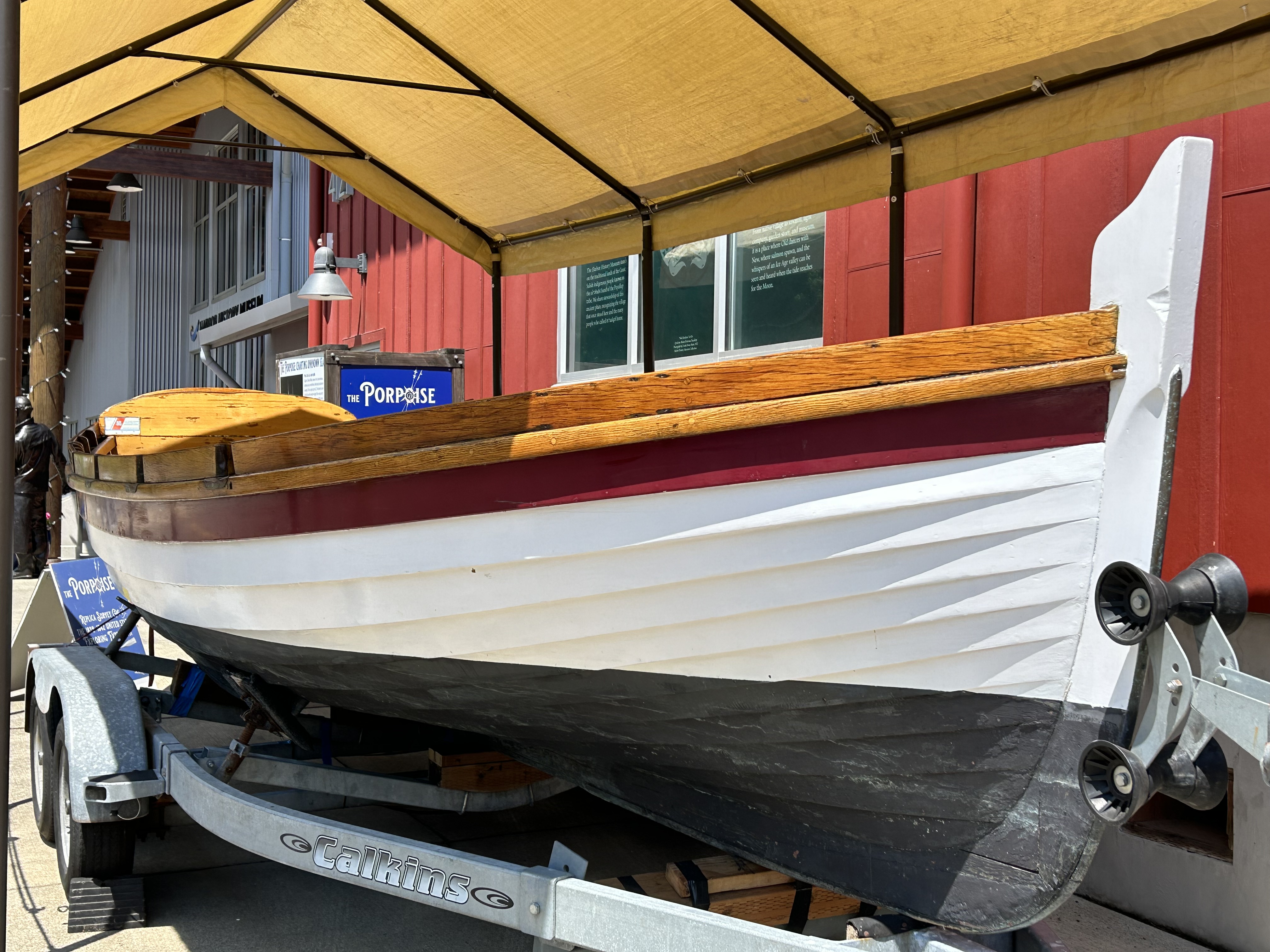
The next day we headed into the Taft Historic Downtown. We are staying in Lincoln City, which was created in 1965. It brought together several, one of which was Taft, which sits at the mouth of the Siletz River. There is very little in this Historic Downtown beyond a few inns and restaurants. But it does sit at the Bar of the Siletz River. When rivers flow out of the Coastal mountains, they carry sand into the ocean. The freshwater slows down as it meets the salt water, and the sand begins to settle. This creates an underwater sandbar at the mouth that requires ships to “cross the bar." This small port was used to ship lumber to San Francisco. This video demonstrates how quickly the river, even a small one, flows when combined with an ebbing tide. This is a place where life flourishes. Sea Lions were resting across the bay on the beach. They are attracted by the fish that gather in the waters just offshore. Birds were everywhere. This is why the Native people settled here centuries before. It is also why Anglos arrived and moved the native people out without compensation. Anglos have not been the heroes of most of the stories of this area.


It was move day and time to leave Lincoln City and head a couple of hours North to Warrenton, OR. However, we planned a little stop at the Tillamook Creamery in Tillamook, OR. We love Tillamook Cheese and make a habit of visiting places that feature our favorite foods. We have seen Cranberry World Headquarters, Chateau Ste. Michelle Winery, and Garlic World. All, except the Garlic world, offered info about how they produced the food. The creamery did not disappoint, in part because it provided samples!!! This is the packaging floor for the cheese. 40 lb. blocks of cheese being unwrapped after aging in the chilled warehouse next door. It is inspected, cut, re-inspected, vacuum wrapped for sale, boxed, and sent out the door. On the other side is the production line, where the milk is received and processed before being pressed into the 40 lb. blocks of unaged cheese. I always loved those TV shows that showed production lines and could have watched these machines for hours. But hunger got the best of us, and we enjoyed an excellent slice of pizza and Spicy Mac N Cheese at the restaurant downstairs. The creamery exists because the abundant rain and rich soils mean the cows have plenty to eat. They rely on the earth, wind, fire, and rain. These four actors are faithful as long as we respect them, and the Tillamook brand is actually a company that grew out of a cooperative of creameries in Tillamook County, OR, who wanted to protect their livelihood and protect the resources of the area. With success, they became a large company with the same values as those early dairy farmers along the Tillamook River.


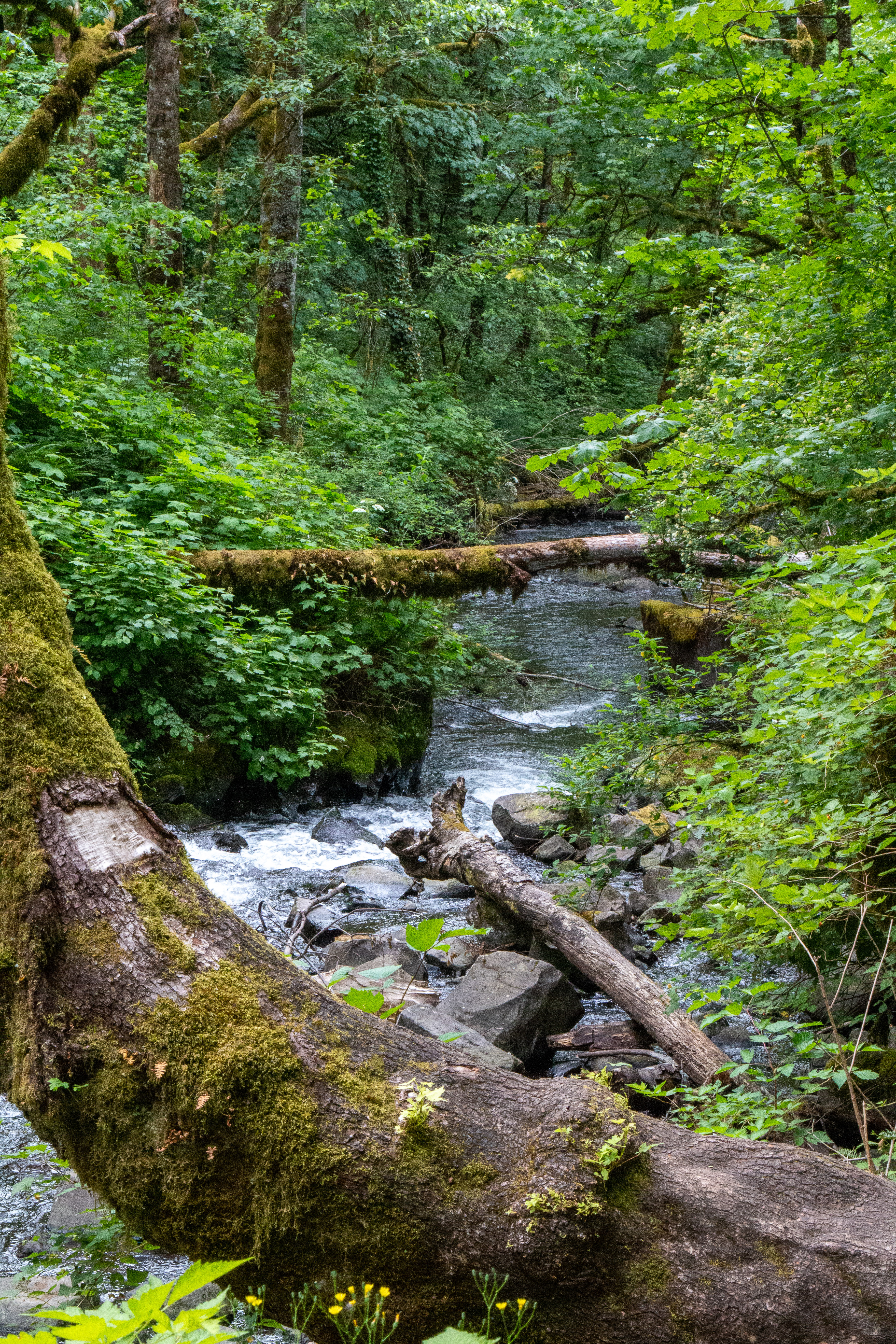
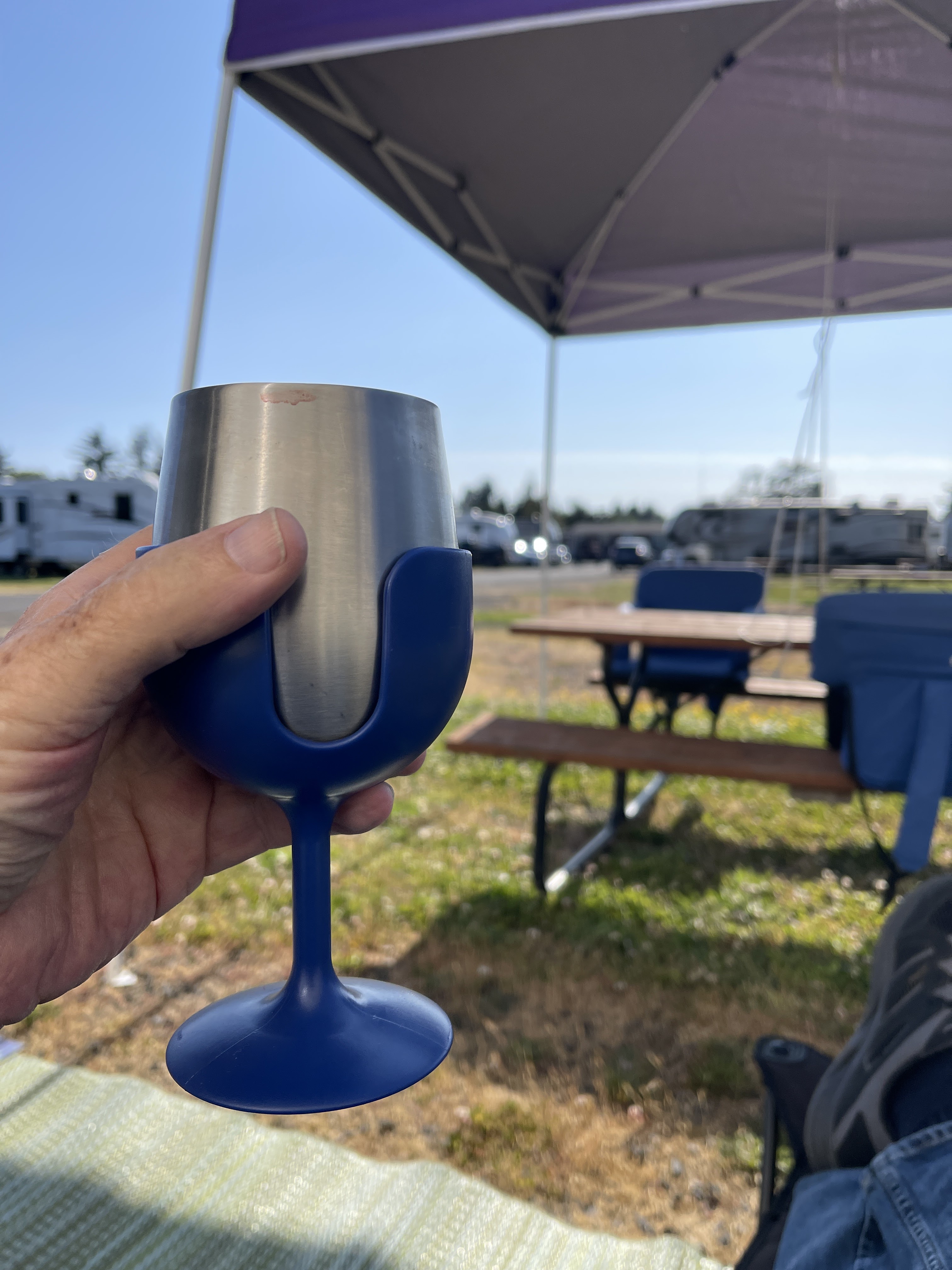
After arriving in Warrenton, we set up for a week at Kampers West RV Park. This is an older park along Alder Creek whose busy season kicks in when the Chinook Salmon and other fish start their run up the Columbia River. We are only ¼ mile from the river and a few miles from Astoria. Washington State sits just across the bridge. After eating the Pizza and Mac-n-Cheese for lunch, we had no energy for anything other than relaxing. I poured my last glass of California Cabernet and toasted an excellent day on the road. 


Even when we are staying in a nothing-fancy park, I find contentment in being on the road. I enjoyed an afternoon listening to the wind blowing through the trees and watching the sparrows, robins, and crows go about their lives around my chair. I was always in a hurry when traveling part-time, especially when we were vacationing. I needed the best parks with the most exciting attractions I could find. I spent days planning and building detailed itineraries that guaranteed we would make the most of our limited time in an area. But our full-time traveling allows us the greatest of luxuries, the opportunity to travel at whatever pace we want. Planning is left to the bare necessities. We can allow each day to unfold as it needs to. Earth, wind, fire, and rain use time to work their magic in nature. I am learning to allow time to transform our travels into the opportunity to “be here in this moment.” And so, I raise my glass to the "nothing-fancy" that has become so extraordinary in our lives on the road.


Fort Stevens was one of three military forts established at the Mouth of the Columbia. As US Secretary of War, Jefferson Davis recommended establishing a military presence on the Columbia to protect the shipping and settlements along the river. He was initially ignored, but the military leaders eventually saw the wisdom and started building a Fort during the Civil War to protect against Confederate forces (under the command of then-Confederate President Jefferson.) Over the years, this piece of military ground assumed greater and greater importance. By WWII, sophisticated weapons and radar systems were installed on both sides of the river. They were attacked only once when the Japanese Submarine I-25 was dispatched to patrol the mouth of the Columbia. They were ordered to attack a suspected Submarine Base and began shelling the David Russel Battery at Fort Stevens. There was no submarine base, but they did commit the first attack on US Continental Soil since 1812. The second occurred later at Bandon. The Commander of Fort Stevens did not fire back to prevent giving the Japanese information about their capabilities. Thus, the extensive weapon systems at these forts were never used. The largest weapons were fired only once to test the firing system. The fortifications were abandoned after the war.  


We found the Pacific Rim Peace Memorial. It is placed by the governments of Japan and the US to remember the events of the only attack by Japan on the continental US with a pledge of eternal peace between the two countries. Though these weapons were never fired, it is interesting that the Submarine Commander later reported that had he known of the firepower of the Fort, he would have never attacked. May these pledges of peace bear fruit as this story unfolds in time.


Above the two jetties that protect the Columbia River channel sits the Cape Disappointment Lighthouse. It warns ships of the 'graveyard of the Pacific," where more than 300 ships lay beneath the waters of the area. The Columbia River is so large that it carries a great deal of sand to the mouth. Early explorers came to the mouth, saw the enormous sand bar (3 miles deep and 6 miles wide), and decided it was just a bay with no access to the interior. One explorer named the headland Cape Disappointment and the water behind the sand bar Deception Bay. Later explorers braved the sandbar and discovered the Columbia River and a path into the interior of the Pacific Northwest.  


This seemingly innocent stretch of ocean is the Columbia Bar. It was a very dangerous crossing to cross until a jetty was built to increase the flow of the river out into deep waters. A second jetty on the north was created to further project the channel into the bay. Despite repeated shipwrecks, it was renamed the Columbia River Bay and became a major port for shipping and passenger service. A lighthouse was built to mark the mouth of the river, but the wrecks continued to pile up on the ocean and bay floors.


A second lighthouse was built on the North Head of Cape Disappointment. This one could be seen by ships coming from the north and served as a warning to avoid the shoals and rocks. Unlike the two lighthouses at Yaquina Bay, both still operate even though they are only a few miles apart. The larger one on the North Head serves as a warning, while the second at the mouth of the river serves as a guide over the Bar. However, every ship that enters the bay must be under the command of a Bar Pilot who studies the constantly changing contours of the Bar and can guide the ship safely to port. These are powerful examples of how life must adapt to the power of earth, rain, wind, and fire in this part of the world. Without respect for these elements, we will be shipwrecks on the sea of time.


I've seen fire, and I've seen rain;

I've seen sunny days that I thought would never end;

I've seen lonely times when I could not find a friend, 

But I always thought that I'd see you again.

Fire and Rain, by James Taylor


Our lighthouses, river jetties, and ships that lay in ruin are important stories. But we, their creators, are not the main actors in this story of the Oregon Pacific Coast. There have been:

·      Native People who used Clovis Points 13,000 years ago,

·      The Clatsop Tribe who settled here for part of the year and dried as much as 10,000 lbs. of salmon that seemed to never run out, 

·      Explorers Lewis and Clark explored and opened the area at the urging of Thomas Jefferson, who believed it was our destiny to rule the entire North American Continent, 

·      US Officials that bargained with local tribes for land and a congress that failed to ratify their treaties, thus committing genocide of the native people,

·      And corporations that believed that they could dominate and exploit the resources and the area at will without consequence or a significant concern for the future.


These are a small fraction of the actors that have played a part in the story of the Oregon Coast. But a bigger story is still unfolding, and we, like that early explorer, will likely be disappointed in the outcome. It will go on with the main actors still playing their parts. Earth, wind, fire, and rain will continue to shape and reshape this place. And, as James Taylor's song reminds us, the future will not be what we thought. 


The wind will continue to blow the seas into swells and storms. The fires will continue to burn deep within the earth and cause cliffs and continents to rise and fall. The rain will continue to fall, causing rivers to flow, filled with sediment and food for the sea life at the mouth of the river. Where are we in the story? Will we have a bit part? Will we be a supporting cast member? Or will we have a significant role? It all depends on how much respect we have for the main characters. But be assured, the story that will unfold with or without us.


To paraphrase James Taylor, “We always thought that we‘d write the end of that story!”


Travel well, my friends,

Bob


Embracing the Possible

The Road has many lessons for the attentive traveler. This week, I am being taught the importance of embracing the possible. Unfortunately, ...