Rain and wind challenged our
week in the Northwoods. Marlene was laid up because of her injury from crossing
the Mississippi River. The swelling is down, but she is still icing and resting
it. The rain and cold winds were also not encouraging for getting out and
about. So, this week's blog will be more about this area and what I have
learned from the Northwoods of Minnesota.
As we explored Bemidji, I
discovered that the lore and popular culture are filled with legends, caricatures,
and mythology. But when I looked beneath them, I found a beach full of stunning
grains of truth! Welcome to Bemidji, the heart of Minnesota's Northwoods and
the home to Paul Bunyan and Babe, The Headwaters of The Mississippi, fascinating
Indian Culture, and a unique geology.
Welcome to Bemidji,MN
Minnesota is known as the Land of 10,000 lakes. These lakes rest in depressions formed when the glaciers retreated 12,000 years ago from a bedrock laid down 1.1 billion years ago. That bedrock of volcanic and sedimentary rock has been kneaded, folded, and eroded by the same forces that created the rest of North America. But starting a little over a million years ago, a series of glacial periods scraped and redeposited moraines, forming huge lakes rivaling the waters of the present-day Great Lakes. They also carved broad valleys and rolling hills. Today, this Land is collectively called the Northwoods because they are home to lakes teeming with Walleye and Muskie, woodlands filled with hundreds of species of birds, beaver, the occasional bear, and the rare moose who wander down from the north. For the last 3,000 years, humans have been moving through the area, leaving indelible marks on the Land.
The Anishinaabe People began migrating from Eastern Canada 500 years ago as they followed the Great Lakes waters. They became known as the Ojibwe to the French and Chippewa to the English. Other groups emerged out of this migration, including the Algonquin and Potawatomie. The Mississauga returned to the Great Lakes. These groups share a common root language, shared beliefs, and a history of care for the Land and waters of the region.
They started at Turtle Island in present-day Montreal. Their second Stopping point was the concave falls, known today as Niagara Falls. They then moved on to the narrow straits of present-day Detroit, where the tribe divided with bands moving in different directions. The Ojibwe continued West and settled along the North Shore of present-day Lake Superior, where we ended our week. This great migration is remembered in the oral traditions of each of the tribes and speaks of a people moving forward under the guidance and protection of the Great Spirit, Gitchi, for whom they named Lake Superior, Gitchigami (Longfellow renamed it Gitchigumi in his poem). The Chippewa are still present on the Land and waters but have yielded much of their influence to the French Voyageurs who came into the area in the 1600s, the British Explorers and trappers who followed them in the early 1700s, and the northern European farmers, shopkeepers and developers who began arriving in the mid to late 1800s.
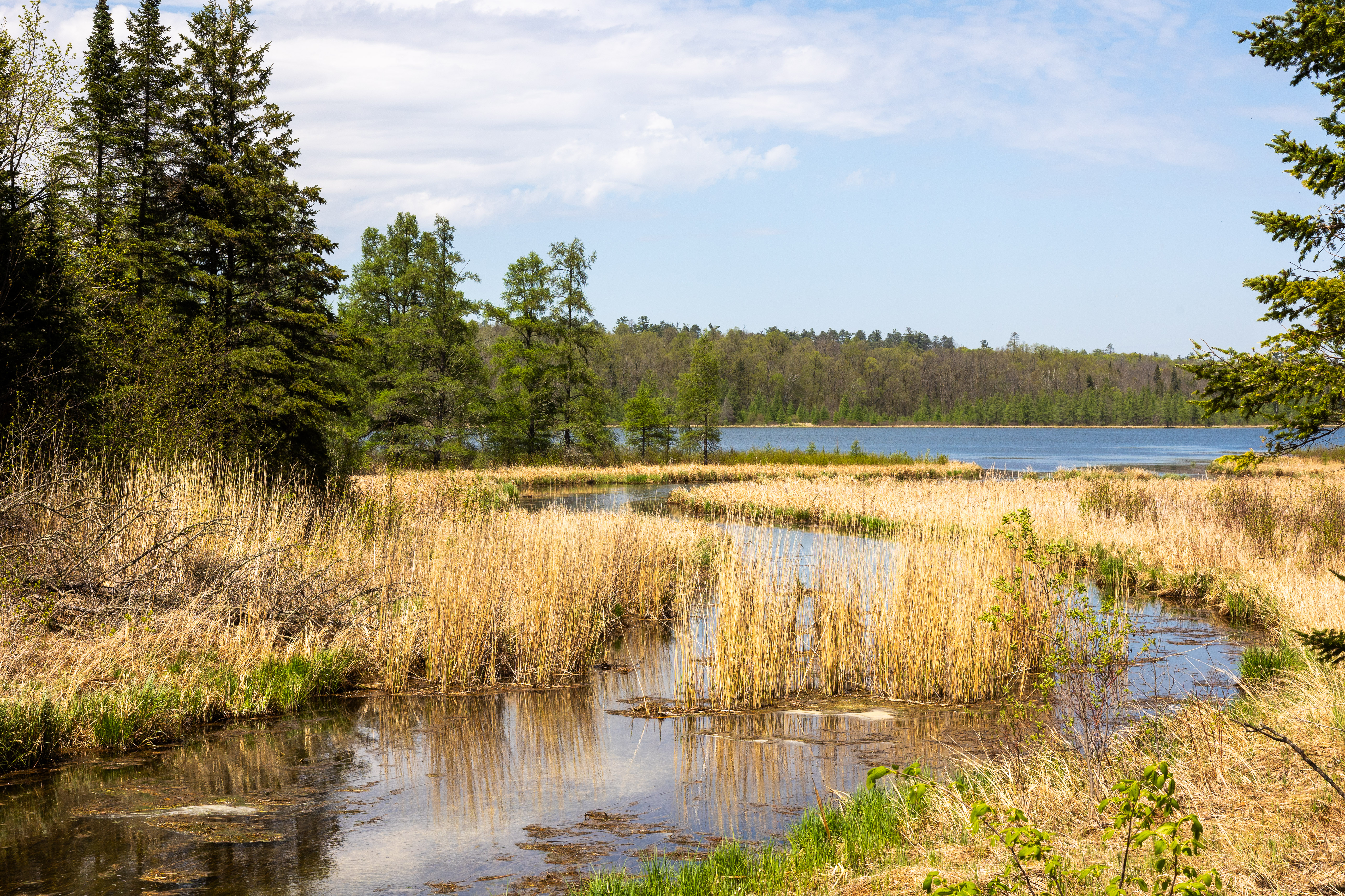
These shopkeepers found a
land dotted with lakes surrounded by marshes and bogs. In places, the water
flowed into small rivers. In 1832, the Indian agent Henry Rowe Schoolcraft, an
Ojibwe guide, and a survey crew set out to explore the Upper Mississippi. Their
expedition was supported by the US Department of War to find and make permanent
peace with the Native people in the area. European Explorers had been searching
for the Headwaters of the Mississippi since it was "discovered" by
DeSoto in 1541. Schoolcraft and his crew navigated the River to a lake the
Guide called Bemidji. But the River appeared and disappeared in the marsh. The
Guide led him to a lake South of Bemidji, which his Guide called Elk Lake. As
they surveyed the area, they discovered the first sustainable flow of water
that he declared the Headwaters of the Mississippi. He renamed the lake Itasca,
from the Latin meaning "true source". While this declaration has
faced many challenges over the years, most cartographers believe that Schoolcraft
was correct.
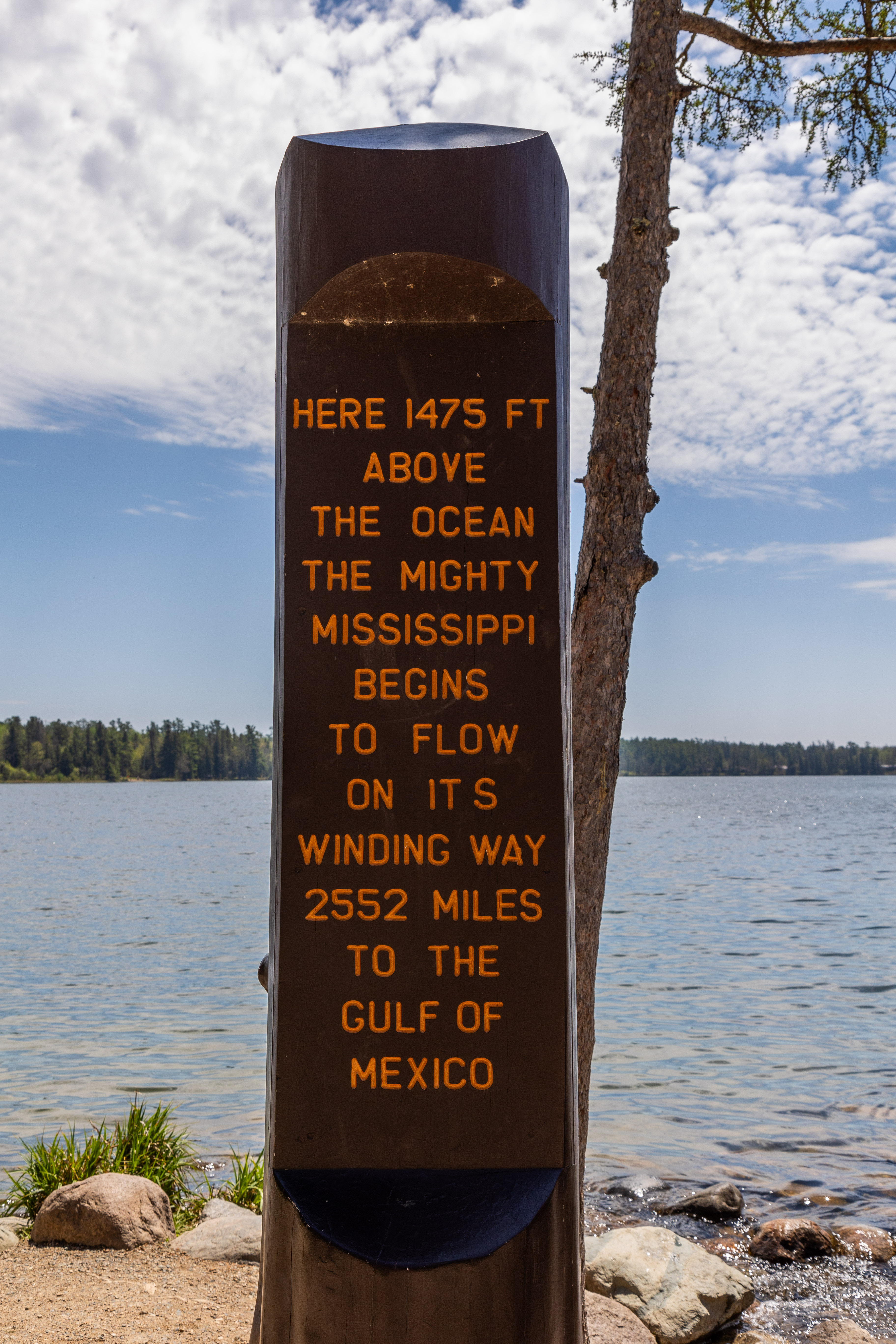
Lake Itasca at the Source of the Mississippi
In the 1930s, FDR’s CCC
came to Lake Itasca and channeled the swamp at the lake's north end, forming a
visible Mississippi River, creating a State Park, and placing large rocks
across the stream where it forms at the shore of the lake. Their work has
become the Headwaters of the Mississippi, where thousands of people have walked
across the Mississippi. But the present layout is deceptive. Land and water are
not distinct elements; they are integrated ecosystems of water, land, flora,
fauna, and human beings that require respect and stewardship to survive the
human footprint.
The Mississippi River
In the 1880s, lumber
mills began to arrive, and the logging industry took root to supply lumber for
the cities springing up all along the Mississippi River to the South. The
loggers discovered an Ojibwe man living by Lake Bemidji. The name means a lake
with rivers on both ends. The man was Shaynowishkung (He Who Rattles).
He hunted in the area as a child and dreamed of returning one day. After losing
his wife, he moved his children to a lodge on the south side of the lake. For
ten years, he watched whites move into the area. He did his best to befriend
them, helping them to see the lake and surrounding forest through his eyes. He believed
they could all live in harmony if they respected the Land, the water, and the
people. But the arrival of the Great Northern Railroad spelled the end of his
time on the lake; the European settlers called him Chief Bemidji after the
lake, and the city that grew along the shores became known as Bemidji. Many
remembered him for the rattles that he wore to shake off negativity within and
around him. But the Railroad needed the lake to ship lumber downriver, and the
Chief was forcibly removed to the Leech Lake Reservation, where he died of
pneumonia a few years later. But the people of Bemidji had not forgotten their
"Chief," and he was returned and buried in the Land he loved.
Chief Bemidji
As logging became the
primary way of life in the Northwoods, people began telling stories that
reflected who they were and what they believed. Legends of a giant lumberjack
named Paul Bunyan and his faithful companion, Babe the Blue Ox. These stories
began in the bunkhouses of logging camps across Southern Canada and the
Northern US. His size and deeds varied with the imaginations of the men telling
the stories and their desire to entertain. Some stories told of his creating
the Grand Canyon by dragging his axe across a desert and forming Lake Bemidji
with his footprint. (The lake is shaped like a boot print in the mud.) This was
our second encounter with statues of Paul Bunyan and Babe. The first was in the
Redwoods of Northern California. As legends or folklore, these stories tell us
about the people who created them. They believed in the human ability to shape
their world. They saw the forest as a subject to be explored and used rather
than as an object of awe and respect. These outsized stories speak of an
outsized culture sweeping through the Northwoods on steel rails and swinging
sharpened steel axes.
Bemidji Visitor Center
Our last day in Bemidji
started out cold and wet, but the Sun finally came out after lunch. We took the
opportunity to do some much-delayed exploring around the city. Our first stop
was Diamond Point Park behind Bemidji State University on the shores of the
lake. We enjoyed a fun hour seeing some familiar birds dressed in their
Springtime finery that we never see in Texas. We watched squirrels and
chipmunks play under the trees. We spotted two new species, the Yellow-throated
Vireo and the Blackpoll Warbler. I also watched either a Beaver or an Otter
swimming along the shore, but only popping up briefly before moving on. We then
moved down to downtown, where we paid homage to Chief Bemidji's Statue and
walked through the Chippewa Trading Post with their re-purposed Muffler Man
Statue, now dressed like an Ojibwe Warrior. It was a fun way to end our stay in
Bemidji.
The Beach at Diamond Point Park
 |
| Paul Bunyan and Babe |


 |
| Re-purposed Muffler Man |
 |
| Rocks from all Fifty States and Canadian Provinces |
 |
| Common Mergansers in Breeding Color |
 |
| Shore of Lake Bemidji |
 |
| Tennessee Warbler |
 |
| Blackpoll Warbler |
 |
| Where's that bug? |
 |
| Eastern Gray Squirrel Hiding |

 |
| Female Common Merganser |

 |
| Eastern Gray Squirrel with Ear Tufts |
 |
| American Crow |
 |
| Playful Buddies |
 |
| Chipmunk |
 |
| Pair of Golden Eye in Breeding Color |
 |
| Spotted Sandpiper |
 |
| Female Goldeneye |
 |
| Chipmunk Portrait |

 |
| Artwork in Downtown Bemidji |
 |
| A Last Goodbye to Paul and Babe |
The next day, we packed up on
another cold, wet morning and made our first southward drive since we had left
the Rio Grande Valley on March 1st. We drove through the Chippewa
National Forest. We crossed a marshy Mississippi River and countless small
lakes and bogs. We arrived in Duluth, MN, and started up the North Shore of
Lake Superior. I am grateful that this was the Thursday before Memorial
Day weekend because this is a trendy destination to begin the Summer. The temps
had warmed somewhat, and the Sun was shining. We set up Koko and settled in for
one day of lousy weather before exploring The North Shore and all its wonders.
Burlington Bay Camground
 |
| Burlington Bay |
 |
| Two Harbors Lighthouse Point |


Reflecting on our second week
in Minnesota, I can appreciate all the legends surrounding this beautiful
countryside. We are seeing it during a wet and cool spring. But a few months
earlier would have been a different story. The lakes freeze with 1-2 feet of
ice each year. The clerk at the Trading Post told us that people who live on
the north side of Lake Bemidji commute across the frozen lake in the winter.
The bitter cold, driven by high winds, makes life a challenge. Yet people have
been living here for at least 3,000 years. The Land is as unforgiving as it is
bountiful. But, to survive and thrive requires resilience and courage that
inspires awe in this Southerner. These people live among legendary creatures in
a land of folklore and campfire stories. I look forward to further exploration
of the Northwoods along the North Shore. This is truly a special place, and
Bemidji has earned the Sun's rays that fill the sky over the city!
Thank you, Bemidji!
I am glad you are along for the ride. I look forward to sharing more of our adventures.
Travel well, my friends!
Bob
 |
| At Elk Lake |


