
“Boozhoo." This is Ojibwa for "Hello." I greet you from The Apostle Islands Area Campground in Bayfield, Wisconsin, where I sit outside Koko and look through the forest to the distant Madeliene Island. This was a challenging week for photography on the road. But, the week has reminded me of a fundamental truth about photography. I call it Bob’s Photo Rule #1: "You can’t photograph what isn’t there!” We have been laid up for nearly a week with a respiratory bug. We spent most of our time on the Northshore of Minnesota sneezing, coughing, and sleeping. We got out on our last full day before driving to Wisconsin the next day. I had very limited opportunities to take photos. (Note the word limited.) All I could photograph was just outside my window in Koko. I can't photograph what isn't there!
However, the week did teach me two new corollaries to this truth. Corollary A reads, “But just because you can’t see it doesn’t mean it’s not there.” In challenging circumstances like our past week, I had to remember to look beyond what I see with new eyes or in new ways. And this proved helpful more than once. But there were times when Corollary B kicked in, “Never Forget Rule # 1!” Yep, it was a challenging week, but I hope it will prove as entertaining for you as it was helpful for me. The journey continues. We begin on our last day in Minnesota (for now) on the Northshore of Gichigami (Lake Superior).

We stayed in Two Harbors, Minnesota, at Burlington Bay Campground. Two Harbors, MN. Two Harbors refers to Burlington Bay and Agates Bay, where iron ore and lumber were loaded onto barges for shipping down the shoreline to Duluth, MN, and Superior, WI. There, it was transferred to Great Lake Steamers for shipping to the growing cities and the Steel Mills of the Midwest. The railroad replaced the barges in time, and fishing and recreation moved in. Today, Two Harbors consists of both communities and serves as a jumping-off point for exploring Minnesota's Northshore of Lake Superior with its lighthouses, scenic rivers, waterfalls, and panoramic vistas of the largest of the Great Lakes.
Here are a few of the pictures I took while we were laid up in Koko.
 |
| Burlington Bay as a Storm Rolls in |


 |
| The View from Koko |


On Wednesday, our heads cleared somewhat. Marlene was still limited by her broken foot, so we spent the last day exploring the wonders of the Northshore of Lake Superior in Nakai. Our first stop was Silver Creek Tunnel. Highway 61, which runs out of Two Harbors, used to go around Silver Creek Cliff with its precipitous drop to the rocks below. This would have been harrowing in the Summer, but it was hazardous in the winter. The State of Minnesota opened the Silver Creek Tunnel in 1994 and left the old roadway as a trail to preserve the beautiful scenic views. Here are a few shots from a small portion of the trail that Marlene could walk with me.
 |
| Lake Superior from Silver Creek Cliff |


 |
| The Tunnel Entrance |


 |
| Old HWY 61 Roadway |
 |
| The Cliff Face |


 |
| The Gooseberry River |
 |
| The Upper Falls |


 |
| The Middle Falls |


 |
| The Lower Falls |

After lunch in Silver Bay, MN, we drove back toward Two
Harbors and stopped at Split Rock Lighthouse. The shores of Lake Superior in
this area are composed of jagged outcroppings of rocks and shoals. As long as
the shore is visible, captains could steer clear. But storms and fog make the
waters very dangerous. In 1855, the Sault St. Marie Locks opened the Great
Lakes to a global market, and the number of ships loading Iron in Duluth and
Superior grew dramatically. By 1905, the appetite for steel drove lake captains
to take greater and greater risks. A single storm in 1905 damaged or sank 29
ships and led to the loss of countless lives. The Federal Government opened the
Split Rock Lighthouse, 130 feet above the water, and equipped it with a light
and foghorn. There have been no more incidents since the station opened. Radar
and GPS rendered the facilities obsolete, and it was closed down. It is now the
most photographed object on the Northshore, as thousands of tourists come here
each year for the grand views. 
A Dangerous Shoreline
Here are a few pics.
 |
| The Fog Horns |
 |
| Split Rock Lighthouse |


 |
| From the Lighthouse Keepers Parlor Window |
 |
| Foghorn Building |
 |
| The Keeper's Parlour |
 |
| The Lighthouse in the Distance |


We drove to our new campsite at the Apostle Islands Area
Campground in Wisconsin on Thursday. I have spent most of my life within a few
miles of I-35. We are about the same age, and I have traveled most of its
length at one time or another. I have driven to the south end in Laredo, along
both the east and west routes through DFW, and on this drive, I drove to the
northern end of it in Duluth, MN. I still have a section around Minneapolis to
drive, but I will not do that on this trip. But I have spent enough time along
it to be able to call it home. When we lived in Missouri and Canada, it always
marked the way home. As we travel around the country, I look at a map, and I 35
offers a pathway back to family and friends. Thanks, Duluth! One of life's
routes is that much closer to being complete.
The Start of I 35
Duluth, MN, and Superior, WI, sit at the Western end of the Great
Lakes on the edge of the great Northern wilderness and, since the opening of
the Sault Ste. Marie Locks, at the start of the global shipping route. The
massive lumber and iron ore resources have built these two cities into large,
wealthy hubs for commerce. If we return to this area, it will be to explore the
people and history of this area. It is far more than commerce; frankly, the
area is beyond beautiful. Yep, this is a region that deserves more than a
fleeting drive-through. 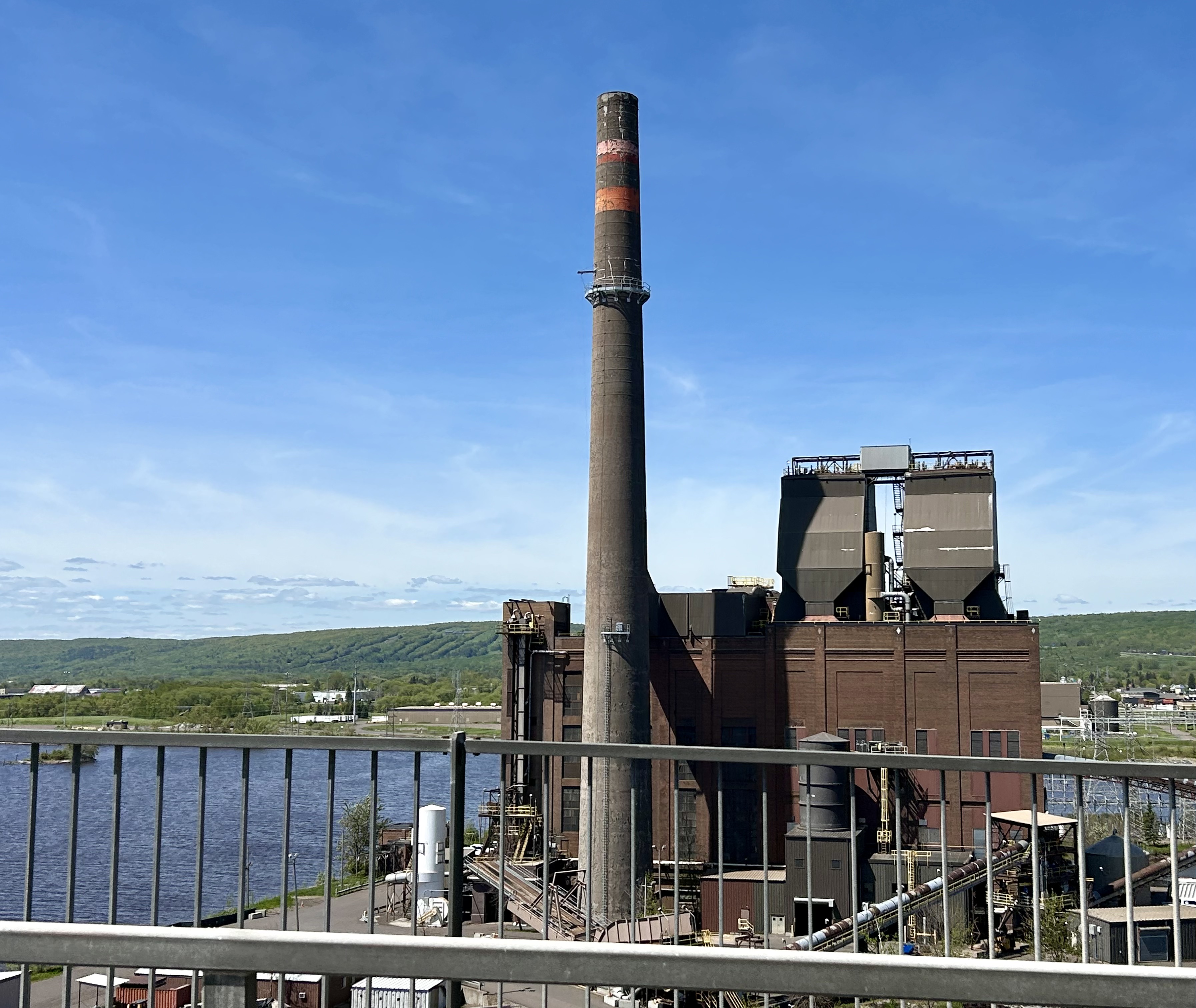
Duluth Harbor
We encountered Muskeg in Ontario 25 years ago. It was one of those
words that has hung around in my lexicon, sadly neglected and usually ignored.
I knew it was a bog that was a step from glacially cleared rock to open water,
to vegetation-filled bog, to hardwood forest. As we drove through the Wisconsin
countryside, the word sprang from the back pages of my mind. In the process, I
learned that it is the Ojibwa word for bog. I can only assume that these
ancient native people still whisper their wisdom through this ageless and
beautiful landscape. It is good to be here among the muskeg of Wisconsin as we
spend five nights at The Apostle Islands Area Campground in Bayfield, WI.
A Nice Site
On Friday, it was time to catch up on some chores and get out and about. We had to make a 15-minute drive to Washburn, WI, to do our laundry. While there, we enjoyed another fried walleye meal. That is, without a doubt, the best-tasting fish I have ever eaten. It has the sweet taste of freshwater and the buttery flavor of the salt water. And I thought redfish and halibut were great! I am looking forward to a few more meals of Walleye. Once the laundry was hung up, we did a quick drive through Bayfield to scope out our opportunities for the next three days of wandering.
It has been a challenging week, but our health and the weather are looking up. We will spend the next few days exploring the Apostle Islands before moving on to Minneapolis/St. Paul for a week. I will do my best to keep my eyes open and pay attention to the wonders that will unfold around us. I must remain mindful of Rule #1; I can't photograph what isn't there!
A favorite Pro Photographer says that there is always a good picture that can be taken. The image is not in the camera; it is in the photographer's mind (and heart) as we interact with the world around us. The camera is a tool to capture and share that image. I can think of no better way to help others see through my eyes or see the world through theirs than by taking a thoughtful picture.
So, welcome to my world! I am glad you are along for the ride.
Travel well!
Bob


No comments:
Post a Comment